So, remember just 24 hours ago when we said that we weren’t buying all of the ridiculous numbers being floated out there because we expected the models to shift the storm a bit eastward? Yeah, the opposite happened.
Hey, we’re the first ones to admit when we are wr….wro…..wro….when our forecast starts going off the track. We wait until we’re fairly sure we’ve got a good forecast before we publish, because we want you to have the best info available. Well, in this case, that didn’t work out. Luckily, we still haven’t gotten into the storm, so we have time to fix things.
The basics that we outlined last night still hold true. Low pressure will move up the East Coast and rapidly intensify, passing south and east of Cape Cod later Tuesday. Strong winds are likely, especially along the coast. Sustained winds of 20-30 mph with gusts to 50 mph inland and possibly 70 mph along the coast. We may have understated the coastal flood threat a bit, but still, any coastal flooding will be minor in nature and confined to right around high tide.
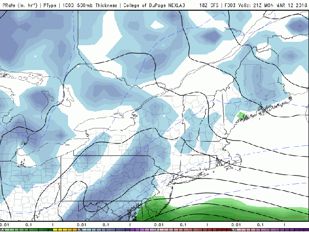
Even the timing is still close to what we were thinking last night. Precipitation should develop near or just after midnight, and quickly get heavy. Blizzard conditions are likely, mainly along the coastline, from daybreak through early afternoon. Snowfall should start to lighten up after midday, but likely doesn’t completely end until late evening or even close to midnight Tuesday night.
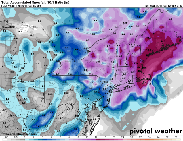
That brings us to the snowfall amounts. There are still some models that are showing amounts that border on ridiculous. As you should know by know, our forecasts, while filled with sarcasm and satire, try to be level-headed, not ridiculous. How much can you expect?
Outside of I-495: 6-12″
Merrimack Valley/Southern NH/NH Seacoast: 8-14″
Most of the remainder of Eastern Massachusetts and Rhode Island: 12-18″
The “jackpot” is likely to be across portions of Plymouth County and onto Cape Cod, where some totals of 18 to perhaps 24″ are possible. The big question here is whether any rain mixes in. This is especially possibly across the Outer Cape and Nantucket. If there is any rain, that will knock accumulations down.
Once the storm moves out, an upper-level low pressure area may trigger additional snow showers on Wednesday and again Thursday (and possibly Friday too). Oh, and since you’re all sick of snowstorms by now, depending on which model you believe, we could have as many as 3 more between now and the end of March. We’ll worry about each of those as they become a threat (or don’t).
